


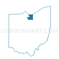
WATER, Erie County, Ohio
About
Outline

Summary
| Unique Area Identifier | 645501 |
| Name | WATER |
| County | Erie County |
| State | Ohio |
| Area (square miles) | 335.61 |
| Land Area (square miles) | 0.06 |
| Water Area (square miles) | 335.55 |
| % of Land Area | 0.02 |
| % of Water Area | 99.98 |
| Latitude of the Internal Point | 41.44028930 |
| Longtitude of the Internal Point | -82.65251790 |
Maps


Graphs
Select a template below for downloading or customizing gragh for WATER, Erie County, Ohio


Neighbors
Neighoring Voting District (by Name) Neighboring Voting District on the Map
- 031 DANBURY 5, Ottawa County, OH
- Voting District 093999, Lorain County, OH
- Voting District 143999, Sandusky County, OH
- PRECINCT BER TWP #1, Erie County, OH
- PRECINCT BV VILL, Erie County, OH
- PRECINCT HUR A, Erie County, OH
- PRECINCT HUR B, Erie County, OH
- PRECINCT HUR E, Erie County, OH
- PRECINCT HUR F, Erie County, OH
- PRECINCT HUR TWP #1, Erie County, OH
- PRECINCT HUR TWP #2, Erie County, OH
- PRECINCT HUR TWP #3, Erie County, OH
- PRECINCT KI VILL, Erie County, OH
- PRECINCT MAR TWP #2, Erie County, OH
- PRECINCT SAN A, Erie County, OH
- PRECINCT SAN B, Erie County, OH
- PRECINCT SAN D, Erie County, OH
- PRECINCT SAN G, Erie County, OH
- PRECINCT SAN M, Erie County, OH
- PRECINCT SAN O, Erie County, OH
- PRECINCT SAN P, Erie County, OH
- PRECINCT VER 1-A, Erie County, OH
- PRECINCT VER 2-A, Erie County, OH
- PRECINCT VER TWP #1, Erie County, OH
- PRECINCT VER TWP #3, Erie County, OH
- PRECINCT VER TWP #4, Erie County, OH
- PRECINCT VER TWP #5, Erie County, OH
- PRECINCT VERMILION CITY 1-A, Lorain County, OH
- Voting District TOWNSEND B, Sandusky County, OH
- WATER, Ottawa County, OH
Top 10 Neighboring County Subdivision (by Population) Neighboring County Subdivision on the Map
- Sandusky city, Erie County, OH (25,793)
- Huron township, Erie County, OH (10,697)
- Brownhelm township, Lorain County, OH (7,618)
- Margaretta township, Erie County, OH (5,981)
- Danbury township, Ottawa County, OH (5,167)
- Vermilion township, Erie County, OH (4,945)
- Vermilion city, Erie County, OH (4,742)
- Berlin township, Erie County, OH (3,723)
- Townsend township, Sandusky County, OH (1,620)
- Bay township, Ottawa County, OH (1,458)
Top 10 Neighboring Place (by Population) Neighboring Place on the Map
- Sandusky city, OH (25,793)
- Vermilion city, OH (10,594)
- Huron city, OH (7,149)
- Bay View village, OH (632)
- Whites Landing CDP, OH (375)
- Crystal Rock CDP, OH (176)
- Beulah Beach CDP, OH (53)
Top 10 Neighboring Unified School District (by Population) Neighboring Unified School District on the Map
- Sandusky City School District, OH (25,770)
- Vermilion Local School District, OH (14,543)
- Perkins Local School District, OH (13,717)
- Huron City School District, OH (10,552)
- Berlin-Milan Local School District, OH (9,464)
- Margaretta Local School District, OH (8,018)
- School District Not Defined (Water), OH (4)
Top 10 Neighboring State Legislative District Lower Chamber (by Population) Neighboring State Legislative District Lower Chamber on the Map
- State House District 58, OH (120,471)
- State House District 81, OH (116,551)
- State House District 80, OH (110,118)
- State House Districts not defined, OH (0)
Top 10 Neighboring State Legislative District Upper Chamber (by Population) Neighboring State Legislative District Upper Chamber on the Map
- State Senate District 13, OH (370,509)
- State Senate District 2, OH (363,296)
- State Senate District 26, OH (347,609)
- State Senate Districts not defined, OH (0)
Top 10 Neighboring 111th Congressional District (by Population) Neighboring 111th Congressional District on the Map
- Congressional District 13, OH (649,102)
- Congressional District 5, OH (627,799)
- Congressional District 9, OH (619,010)
Top 10 Neighboring Census Tract (by Population) Neighboring Census Tract on the Map
- Census Tract 417, Erie County, OH (6,612)
- Census Tract 301, Lorain County, OH (6,545)
- Census Tract 403, Erie County, OH (6,170)
- Census Tract 401, Erie County, OH (5,652)
- Census Tract 404, Erie County, OH (5,621)
- Census Tract 9621, Sandusky County, OH (5,008)
- Census Tract 405, Erie County, OH (4,805)
- Census Tract 408, Erie County, OH (4,398)
- Census Tract 402, Erie County, OH (4,035)
- Census Tract 407, Erie County, OH (3,831)